
Dikkelvenne topographic map
Interactive map
Click on the map to display elevation.
About this map
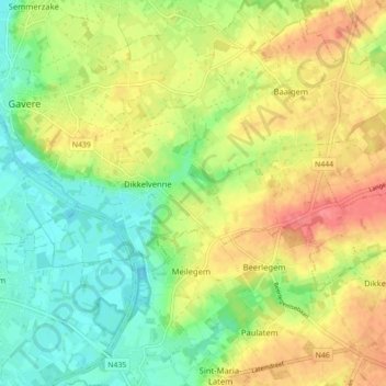
Name: Dikkelvenne topographic map, elevation, terrain.
Location: Dikkelvenne, Gavere, Gent, Oost-Vlaanderen, Vlaanderen, België (50.90237 3.66805 50.93041 3.75568)
Average elevation: 27 m
Minimum elevation: 3 m
Maximum elevation: 63 m