
F/S Ward topographic map
Interactive map
Click on the map to display elevation.
About this map
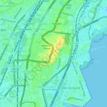
Name: F/S Ward topographic map, elevation, terrain.
Location: F/S Ward, Zone 2, Mumbai, Mumbai City, Maharashtra, India (18.97837 72.83302 19.01697 72.86979)
Average elevation: 8 m
Minimum elevation: -1 m
Maximum elevation: 29 m
Other topographic maps
Click on a map to view its topography, its elevation and its terrain.
Dharavi
India > Maharashtra > Mumbai
Dharavi, Zone 2, Mumbai, Mumbai City, Maharashtra, India
Average elevation: 6 m