
Houthalen topographic map
Interactive map
Click on the map to display elevation.
About this map
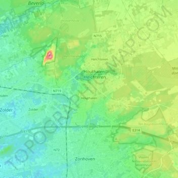
Name: Houthalen topographic map, elevation, terrain.
Average elevation: 58 m
Minimum elevation: 26 m
Maximum elevation: 142 m
Other topographic maps
Click on a map to view its topography, its elevation and its terrain.
Helchteren
België > Limburg > Maaseik > Houthalen-Helchteren
Helchteren, Houthalen-Helchteren, Maaseik, Limburg, Vlaanderen, België
Average elevation: 68 m
Houthalen-Oost
België > Limburg > Maaseik > Houthalen-Helchteren > Houthalen
Houthalen-Oost, Houthalen, Houthalen-Helchteren, Maaseik, Limburg, Vlaanderen, België
Average elevation: 78 m