
Frankfurt topographic map
Interactive map
Click on the map to display elevation.
About this map
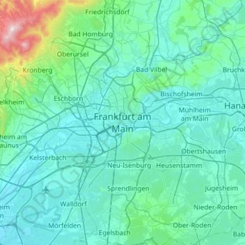
Name: Frankfurt topographic map, elevation, terrain.
Location: Frankfurt, Regierungsbezirk Darmstadt, Hessen, 60311, Duitsland (49.95064 8.52209 50.27064 8.84209)
Average elevation: 162 m
Minimum elevation: 86 m
Maximum elevation: 882 m