
Gadeokdo Island topographic map
Interactive map
Click on the map to display elevation.
About this map
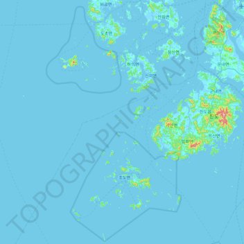
Name: Gadeokdo Island topographic map, elevation, terrain.
Location: Gadeokdo Island, Jindo-gun, South Jeolla, South Korea (34.13343 125.67912 34.77343 126.31912)
Average elevation: 8 m
Minimum elevation: -2 m
Maximum elevation: 461 m