
Laghoualem topographic map
Interactive map
Click on the map to display elevation.
About this map
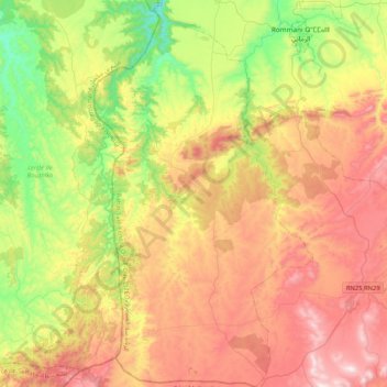
Name: Laghoualem topographic map, elevation, terrain.
Average elevation: 546 m
Minimum elevation: 159 m
Maximum elevation: 1,000 m
Other topographic maps
Click on a map to view its topography, its elevation and its terrain.
Ain Sbit
Ain Sbit, caïdat de Marchouch, cercle de Rommani, Province de Khémisset, Rabat-Salé-Kénitra, 15152, Maroc
Average elevation: 519 m