
Thank you for supporting this site ❤️
Make a donation
Make a donation
Fort Bend County topographic map
Click on the map to display elevation.
Thank you for supporting this site ❤️
Make a donation
Make a donation
About this map
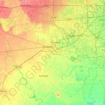
Name: Fort Bend County topographic map, elevation, terrain.
Location: Fort Bend County, Texas, United States (29.26254 -96.08918 29.78862 -95.42398)
Average elevation: 28 m
Minimum elevation: 6 m
Maximum elevation: 54 m
Thank you for supporting this site ❤️
Make a donation
Make a donation