
Sottrum topographic map
Interactive map
Click on the map to display elevation.
About this map
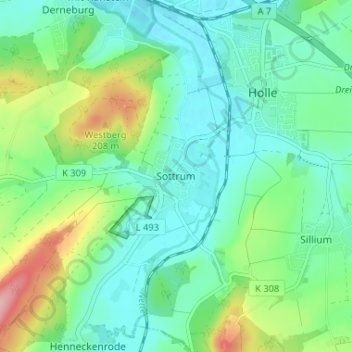
Name: Sottrum topographic map, elevation, terrain.
Average elevation: 131 m
Minimum elevation: 90 m
Maximum elevation: 241 m
Other topographic maps
Click on a map to view its topography, its elevation and its terrain.
Grasdorf
Deutschland > Niedersachsen > Landkreis Hildesheim > Holle
Grasdorf, Holle, Landkreis Hildesheim, Niedersachsen, 31188, Deutschland
Average elevation: 125 m
Sillium
Deutschland > Niedersachsen > Landkreis Hildesheim > Holle > Sillium
Sillium, Holle, Landkreis Hildesheim, Niedersachsen, 31188, Deutschland
Average elevation: 134 m
Heersum
Deutschland > Niedersachsen > Landkreis Hildesheim > Holle
Heersum, Holle, Landkreis Hildesheim, Niedersachsen, 31188, Deutschland
Average elevation: 130 m