
Singampunari topographic map
Interactive map
Click on the map to display elevation.
About this map
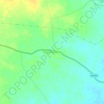
Name: Singampunari topographic map, elevation, terrain.
Average elevation: 139 m
Minimum elevation: 129 m
Maximum elevation: 153 m
Other topographic maps
Click on a map to view its topography, its elevation and its terrain.
Vairavanpatti
India > Tamil Nadu > Thiruppathur
Vairavanpatti, Thiruppathur, Sivagangai District, Tamil Nadu, 630207, India
Average elevation: 103 m
Pillayarpatti
India > Tamil Nadu > Thiruppathur
Pillayarpatti, Thiruppathur, Sivagangai District, Tamil Nadu, 630207, India
Average elevation: 107 m