
Adenstedt topographic map
Interactive map
Click on the map to display elevation.
About this map
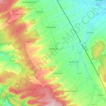
Name: Adenstedt topographic map, elevation, terrain.
Average elevation: 223 m
Minimum elevation: 118 m
Maximum elevation: 376 m
Other topographic maps
Click on a map to view its topography, its elevation and its terrain.
Grafelde
Deutschland > Niedersachsen > Landkreis Hildesheim > Sibbesse
Grafelde, Sibbesse, Landkreis Hildesheim, Niedersachsen, 31079, Deutschland
Average elevation: 209 m