
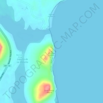
Cerro La Mancha topographic map
Interactive map
Click on the map to display elevation.
About this map
Name: Cerro La Mancha topographic map, elevation, terrain.
Location: Cerro La Mancha, Actopan, Veracruz, México (19.58395 -96.37860 19.58405 -96.37850)
Average elevation: 10 m
Minimum elevation: 0 m
Maximum elevation: 107 m
Other topographic maps
Click on a map to view its topography, its elevation and its terrain.
Barra Juan Ángel
Barra Juan Ángel, Actopan, Veracruz, México
Average elevation: 28 m