
Thank you for supporting this site ❤️
Make a donation
Make a donation
Kinglake topographic map
Click on the map to display elevation.
Thank you for supporting this site ❤️
Make a donation
Make a donation
About this map
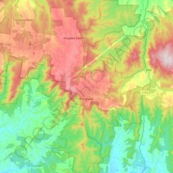
Name: Kinglake topographic map, elevation, terrain.
Location: Kinglake, Shire of Murrindindi, Victoria, 3763, Australia (-37.61044 145.27660 -37.42948 145.42187)
Average elevation: 361 m
Minimum elevation: 102 m
Maximum elevation: 729 m
Thank you for supporting this site ❤️
Make a donation
Make a donation
Other topographic maps
Click on a map to view its topography, its elevation and its terrain.