
Freixo da Serra topographic map
Interactive map
Click on the map to display elevation.
About this map
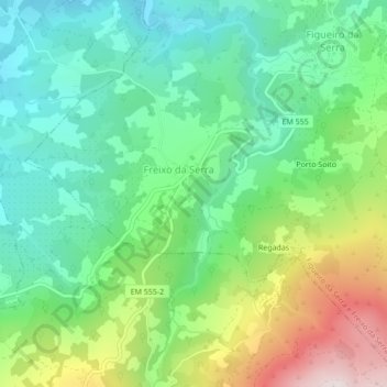
Name: Freixo da Serra topographic map, elevation, terrain.
Average elevation: 682 m
Minimum elevation: 447 m
Maximum elevation: 1,172 m
Other topographic maps
Click on a map to view its topography, its elevation and its terrain.
Figueiró da Serra
Portugal > Centro > Figueiró da Serra e Freixo da Serra
Figueiró da Serra, Figueiró da Serra e Freixo da Serra, Gouveia, Guarda, Serra da Estrela, Centro, 6290-071, Portugal
Average elevation: 772 m