
Les Friats topographic map
Interactive map
Click on the map to display elevation.
About this map
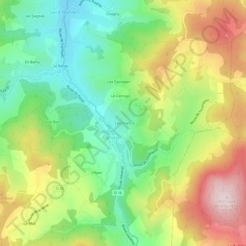
Name: Les Friats topographic map, elevation, terrain.
Average elevation: 583 m
Minimum elevation: 397 m
Maximum elevation: 840 m
Other topographic maps
Click on a map to view its topography, its elevation and its terrain.
La Grosne Orientale
France > Auvergne-Rhône-Alpes > Rhône > Deux-Grosnes > Ouroux
La Grosne Orientale, La Rivière, Ouroux, Deux-Grosnes, Villefranche-sur-Saône, Rhône, Circonscription départementale du Rhône, Auvergne-Rhône-Alpes, France métropolitaine, 69860, France
Average elevation: 568 m