
Espiritu Santo topographic map
Interactive map
Click on the map to display elevation.
About this map
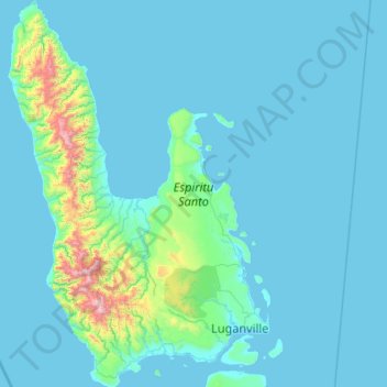
Name: Espiritu Santo topographic map, elevation, terrain.
Location: Espiritu Santo, Luganville, Sanma, Vanuatu (-15.66893 166.54148 -14.64344 167.25971)
Average elevation: 113 m
Minimum elevation: 0 m
Maximum elevation: 1,818 m