
Rock Island State Park topographic map
Interactive map
Click on the map to display elevation.
About this map
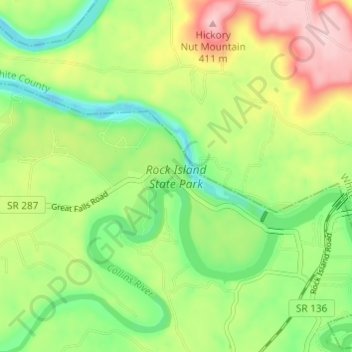
Name: Rock Island State Park topographic map, elevation, terrain.
Average elevation: 281 m
Minimum elevation: 188 m
Maximum elevation: 416 m
Other topographic maps
Click on a map to view its topography, its elevation and its terrain.
McMinnville
United States > Tennessee > Warren County
McMinnville, Warren County, Middle Tennessee, Tennessee, 37110, United States
Average elevation: 302 m
Oakland
United States > Tennessee > Warren County
Oakland, Warren County, Middle Tennessee, Tennessee, 37110, United States
Average elevation: 301 m
Morrison
United States > Tennessee > Warren County
Morrison, Warren County, Tennessee, United States
Average elevation: 323 m
Ben Lomond Mountain
United States > Tennessee > Warren County
Ben Lomond Mountain, Warren County, Tennessee, United States
Average elevation: 455 m
Smartt
United States > Tennessee > Warren County
Smartt, Warren County, Tennessee, United States
Average elevation: 300 m