
Jupagenombe topographic map
Interactive map
Click on the map to display elevation.
About this map
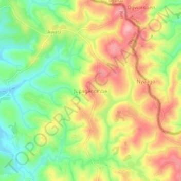
Name: Jupagenombe topographic map, elevation, terrain.
Location: Jupagenombe, Ituri, DR Congo (2.32986 30.84572 2.36986 30.88572)
Average elevation: 1,655 m
Minimum elevation: 1,588 m
Maximum elevation: 1,721 m