
Obergschwend topographic map
Interactive map
Click on the map to display elevation.
About this map
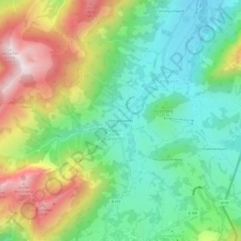
Name: Obergschwend topographic map, elevation, terrain.
Average elevation: 1,236 m
Minimum elevation: 984 m
Maximum elevation: 1,678 m
Other topographic maps
Click on a map to view its topography, its elevation and its terrain.
Untergschwend
Deutschland > Bayern > Landkreis Oberallgäu > Bad Hindelang > Unterjoch > Untergschwend
Untergschwend, Unterjoch, Bad Hindelang, Landkreis Oberallgäu, Bayern, 87541, Deutschland
Average elevation: 1,185 m