
Lamiña topographic map
Interactive map
Click on the map to display elevation.
About this map
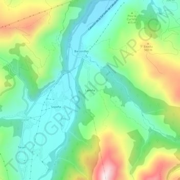
Name: Lamiña topographic map, elevation, terrain.
Location: Lamiña, Ruente, Saja-Nansa, Cantabria, 39513, España (43.21302 -4.30164 43.25302 -4.26164)
Average elevation: 381 m
Minimum elevation: 194 m
Maximum elevation: 769 m