
Halunuk topographic map
Interactive map
Click on the map to display elevation.
About this map
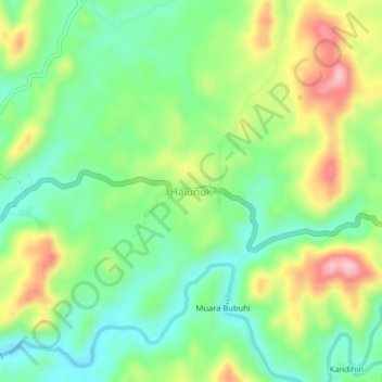
Name: Halunuk topographic map, elevation, terrain.
Location: Halunuk, Hulu Sungai Selatan, South Kalimantan, Indonesia (-2.83868 115.34945 -2.79868 115.38945)
Average elevation: 128 m
Minimum elevation: 54 m
Maximum elevation: 250 m