
Boumekhlouf topographic map
Interactive map
Click on the map to display elevation.
About this map
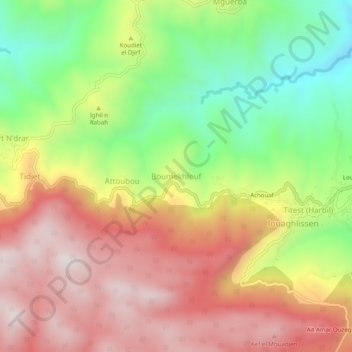
Name: Boumekhlouf topographic map, elevation, terrain.
Location: Boumekhlouf, Daïra Guenzet, Sétif, Algérie (36.30860 4.88795 36.34860 4.92795)
Average elevation: 1,145 m
Minimum elevation: 770 m
Maximum elevation: 1,494 m