
Thank you for supporting this site ❤️
Make a donation
Make a donation
Forest Grove topographic map
Click on the map to display elevation.
Thank you for supporting this site ❤️
Make a donation
Make a donation
About this map
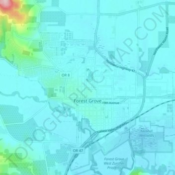
Name: Forest Grove topographic map, elevation, terrain.
Average elevation: 61 m
Minimum elevation: 42 m
Maximum elevation: 275 m
Thank you for supporting this site ❤️
Make a donation
Make a donation
Other topographic maps
Click on a map to view its topography, its elevation and its terrain.
Thank you for supporting this site ❤️
Make a donation
Make a donation
Vern Galaway Memorial Park
United States > Oregon > Washington County > North Plains
Average elevation: 56 m