
Haskayne topographic map
Interactive map
Click on the map to display elevation.
About this map
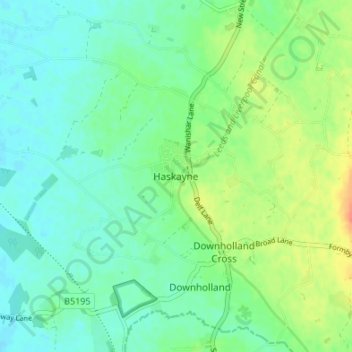
Name: Haskayne topographic map, elevation, terrain.
Average elevation: 13 m
Minimum elevation: 1 m
Maximum elevation: 38 m
Other topographic maps
Click on a map to view its topography, its elevation and its terrain.
Skelmersdale
United Kingdom > England > Lancashire > West Lancashire
Skelmersdale, West Lancashire, Lancashire, England, WN8 6ES, United Kingdom
Average elevation: 68 m