
Magalau Hulu topographic map
Interactive map
Click on the map to display elevation.
About this map
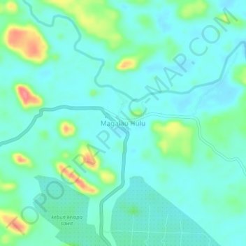
Name: Magalau Hulu topographic map, elevation, terrain.
Location: Magalau Hulu, Kotabaru, South Kalimantan, Indonesia (-2.68558 116.05745 -2.64558 116.09745)
Average elevation: 33 m
Minimum elevation: 15 m
Maximum elevation: 94 m