
Serra topographic map
Interactive map
Click on the map to display elevation.
About this map
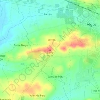
Name: Serra topographic map, elevation, terrain.
Location: Serra, Algoz e Tunes, Silves, Faro, 8365-062, Portugal (37.15710 -8.31645 37.15720 -8.31635)
Average elevation: 47 m
Minimum elevation: 20 m
Maximum elevation: 93 m
Other topographic maps
Click on a map to view its topography, its elevation and its terrain.
Baiães
Portugal > Faro > Algoz e Tunes > Algoz
Baiães, Algoz, Algoz e Tunes, Silves, Faro, 8200-553, Portugal
Average elevation: 67 m