
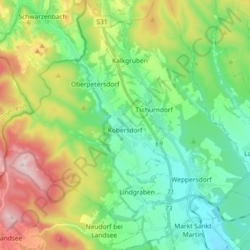
Kobersdorf topographic map
Interactive map
Click on the map to display elevation.
About this map
Name: Kobersdorf topographic map, elevation, terrain.
Average elevation: 429 m
Minimum elevation: 276 m
Maximum elevation: 749 m
Vor Christi Geburt war das Gebiet Teil des keltischen Königreiches Noricum und gehörte zur Umgebung der keltischen Höhensiedlung Burg auf dem Schwarzenbacher Burgberg.
Other topographic maps
Click on a map to view its topography, its elevation and its terrain.
Gemeinde Piringsdorf
Österreich > Burgenland > Bezirk Oberpullendorf
Gemeinde Piringsdorf, Bezirk Oberpullendorf, Burgenland, 7373, Österreich
Average elevation: 369 m
Gemeinde Kaisersdorf
Österreich > Burgenland > Bezirk Oberpullendorf
Gemeinde Kaisersdorf, Bezirk Oberpullendorf, Burgenland, 7342, Österreich
Average elevation: 401 m
Mannersdorf an der Rabnitz
Österreich > Burgenland > Bezirk Oberpullendorf
Mannersdorf an der Rabnitz, Bezirk Oberpullendorf, Burgenland, 7444, Österreich
Average elevation: 306 m
Glashütten bei Langeck im Burgenland
Österreich > Burgenland > Bezirk Oberpullendorf
Glashütten bei Langeck im Burgenland, Lockenhaus, Bezirk Oberpullendorf, Burgenland, 7442, Österreich
Average elevation: 559 m
Gemeinde Steinberg-Dörfl
Österreich > Burgenland > Bezirk Oberpullendorf
Gemeinde Steinberg-Dörfl, Bezirk Oberpullendorf, Burgenland, 7453, Österreich
Average elevation: 294 m
Gemeinde Draßmarkt
Österreich > Burgenland > Bezirk Oberpullendorf
Gemeinde Draßmarkt, Bezirk Oberpullendorf, Burgenland, 7372, Österreich
Average elevation: 387 m
Nikitsch
Österreich > Burgenland > Bezirk Oberpullendorf
Nikitsch, Bezirk Oberpullendorf, Burgenland, 7302, Österreich
Average elevation: 245 m
Bezirk Oberpullendorf
Österreich > Burgenland > Bezirk Oberpullendorf
Bezirk Oberpullendorf, Burgenland, Österreich
Average elevation: 355 m
Kroatisch Minihof
Österreich > Burgenland > Bezirk Oberpullendorf > Kroatisch Minihof
Kroatisch Minihof, Nikitsch, Bezirk Oberpullendorf, Burgenland, 7302, Österreich
Average elevation: 258 m
Kleinmutschen
Österreich > Burgenland > Bezirk Oberpullendorf > Frankenau-Unterpullendorf > Kleinmutschen
Kleinmutschen, Frankenau-Unterpullendorf, Bezirk Oberpullendorf, Burgenland, 7452, Österreich
Average elevation: 243 m
Oberpullendorf
Österreich > Burgenland > Bezirk Oberpullendorf > Oberpullendorf
Oberpullendorf, Bezirk Oberpullendorf, Burgenland, 7350, Österreich
Average elevation: 276 m
Lockenhaus
Österreich > Burgenland > Bezirk Oberpullendorf > Lockenhaus
Lockenhaus, Bezirk Oberpullendorf, Burgenland, 7442, Österreich
Average elevation: 492 m
Gemeinde Deutschkreutz
Österreich > Burgenland > Bezirk Oberpullendorf > Gemeinde Deutschkreutz
Gemeinde Deutschkreutz, Bezirk Oberpullendorf, Burgenland, 7301, Österreich
Average elevation: 210 m