
Thank you for supporting this site ❤️
Make a donation
Make a donation
Altarnun topographic map
Click on the map to display elevation.
Thank you for supporting this site ❤️
Make a donation
Make a donation
About this map
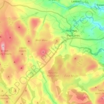
Name: Altarnun topographic map, elevation, terrain.
Location: Altarnun, Cornwall, England, United Kingdom (50.54269 -4.60409 50.62796 -4.46632)
Average elevation: 260 m
Minimum elevation: 128 m
Maximum elevation: 413 m
Thank you for supporting this site ❤️
Make a donation
Make a donation
Other topographic maps
Click on a map to view its topography, its elevation and its terrain.