
Brantu ezers topographic map
Interactive map
Click on the map to display elevation.
About this map
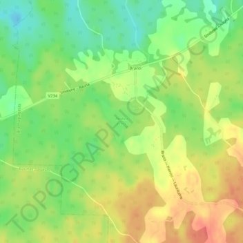
Name: Brantu ezers topographic map, elevation, terrain.
Average elevation: 199 m
Minimum elevation: 171 m
Maximum elevation: 226 m
Other topographic maps
Click on a map to view its topography, its elevation and its terrain.
Brantu dzirnavezers
Latvia > Vidzeme > Raunas pagasts
Brantu dzirnavezers, Smiltenes iela, Bormaņi 1, Raunas pagasts, Raunas novads, Vidzeme, LV-4131, Latvia
Average elevation: 191 m