
Rahimyar Khan topographic map
Interactive map
Click on the map to display elevation.
Rahimyar Khan
</p>City in Punjab, PakistanRahim Yar Khanرحیم یار خانCityRahim Yar KhanLocation of Rahim Yar KhanShow map of Punjab, PakistanRahim Yar KhanRahim Yar Khan (Pakistan)Show map of PakistanCoordinates: 28°25′12″N 70°18′0″E / 28.42000°N 70.30000°E / 28.42000; 70.30000Coordinates: 28°25′12″N 70°18′0″E / 28.42000°N 70.30000°E / 28.42000; 70.30000CountryPakistanProvincePunjabDistrictRahim Yar KhanGovernment • Deputy Commissioner Rahim Yar KhanAli ShehzadArea • Total45 km2 (17 sq mi)Elevation80 m (260 ft)Population • Estimate (2017)420,419Time zoneUTC+5 (PST)Calling code068Number of tehsils4Number of Union councils139 <p>Rahim Yar Khan ( رحیم یار خان) is a city in Punjab province of Pakistan. It is the 17th largest city of Pakistan. According to the 2017 Census of Pakistan, its population is 420,419.
About this map
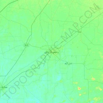
Name: Rahimyar Khan topographic map, elevation, terrain.
Location: Rahimyar Khan, Punjab, 64200, Pakistan (28.25761 70.14365 28.57761 70.46365)
Average elevation: 82 m
Minimum elevation: 75 m
Maximum elevation: 104 m