
Máximo Gómez topographic map
Interactive map
Click on the map to display elevation.
About this map
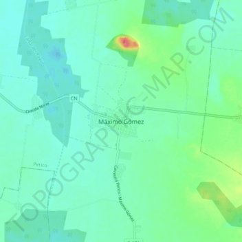
Name: Máximo Gómez topographic map, elevation, terrain.
Location: Máximo Gómez, Perico, Matanzas, Cuba (22.86166 -81.07223 22.94166 -80.99223)
Average elevation: 20 m
Minimum elevation: 5 m
Maximum elevation: 77 m
Other topographic maps
Click on a map to view its topography, its elevation and its terrain.
Valdivieso
Cuba > Matanzas > Martí > 28 de Octubre
Valdivieso, 28 de Octubre, Martí, Matanzas, Cuba
Average elevation: 9 m
Playa Larga
Cuba > Matanzas > Ciénaga de Zapata
Playa Larga, Ciénaga de Zapata, Matanzas, 34000, Cuba
Average elevation: 3 m