
Maibelle topographic map
Interactive map
Click on the map to display elevation.
About this map
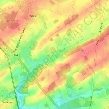
Name: Maibelle topographic map, elevation, terrain.
Location: Maibelle, Assesse, Namen, Wallonië, 5334, België (50.33887 5.06342 50.37887 5.10342)
Average elevation: 275 m
Minimum elevation: 225 m
Maximum elevation: 317 m
Other topographic maps
Click on a map to view its topography, its elevation and its terrain.