
Kalarama topographic map
Interactive map
Click on the map to display elevation.
About this map
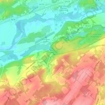
Name: Kalarama topographic map, elevation, terrain.
Average elevation: 154 m
Minimum elevation: 92 m
Maximum elevation: 227 m
Other topographic maps
Click on a map to view its topography, its elevation and its terrain.
Blairstown
United States > New Jersey > Warren County > Blairstown
Blairstown, Warren County, New Jersey, 07825, United States
Average elevation: 196 m