
Conway topographic map
Interactive map
Click on the map to display elevation.
About this map
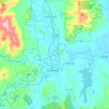
Name: Conway topographic map, elevation, terrain.
Location: Conway, Carroll County, New Hampshire, United States (43.92424 -71.16673 44.07709 -70.99318)
Average elevation: 256 m
Minimum elevation: 122 m
Maximum elevation: 951 m