
Gwaelod-y-garth topographic map
Interactive map
Click on the map to display elevation.
About this map
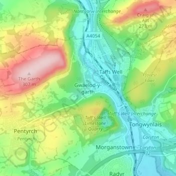
Name: Gwaelod-y-garth topographic map, elevation, terrain.
Location: Gwaelod-y-garth, Cardiff, Gales, CF15 9HG, Reino Unido (51.51991 -3.29283 51.55991 -3.25283)
Average elevation: 124 m
Minimum elevation: 23 m
Maximum elevation: 303 m