
Pedro Escobedo topographic map
Interactive map
Click on the map to display elevation.
About this map
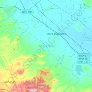
Name: Pedro Escobedo topographic map, elevation, terrain.
Location: Pedro Escobedo, Querétaro, 76720, Mexico (20.35849 -100.29865 20.57925 -100.04096)
Average elevation: 2,037 m
Minimum elevation: 1,891 m
Maximum elevation: 2,777 m