
Horsford topographic map
Interactive map
Click on the map to display elevation.
About this map
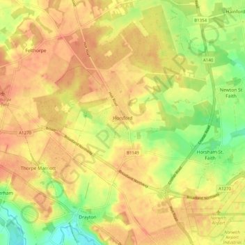
Name: Horsford topographic map, elevation, terrain.
Location: Horsford, Broadland, Norfolk, England, United Kingdom (52.66834 1.21698 52.72843 1.28022)
Average elevation: 29 m
Minimum elevation: 2 m
Maximum elevation: 44 m
Other topographic maps
Click on a map to view its topography, its elevation and its terrain.