
Railay topographic map
Interactive map
Click on the map to display elevation.
About this map
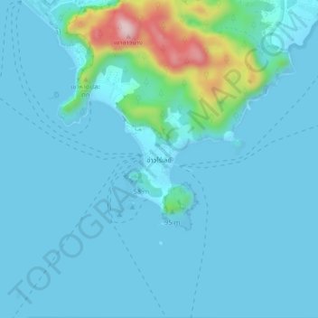
Name: Railay topographic map, elevation, terrain.
Location: Railay, Krabi Province, 81000, Thailand (7.99068 98.81966 8.03068 98.85966)
Average elevation: 35 m
Minimum elevation: -2 m
Maximum elevation: 315 m
Other topographic maps
Click on a map to view its topography, its elevation and its terrain.
Phi Phi Islands
Thailand > Krabi Province > Ao Nang
Phi Phi Islands, Ao Nang, Krabi Province, Thailand
Average elevation: 2 m
Laem Pho
Thailand > Krabi Province > Haad Yao
Laem Pho, Haad Yao, Krabi Province, Thailand
Average elevation: 8 m
Plairpraya
Thailand > Krabi Province > Plairpraya
Plairpraya, Krabi Province, Thailand
Average elevation: 71 m