
Cayo Santa María topographic map
Interactive map
Click on the map to display elevation.
About this map
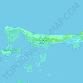
Name: Cayo Santa María topographic map, elevation, terrain.
Location: Cayo Santa María, Caibarién, Villa Clara, Cuba (22.61368 -79.09110 22.69368 -79.01110)
Average elevation: 1 m
Minimum elevation: -2 m
Maximum elevation: 18 m
Other topographic maps
Click on a map to view its topography, its elevation and its terrain.