
Puti topographic map
Interactive map
Click on the map to display elevation.
About this map
Name: Puti topographic map, elevation, terrain.
Average elevation: 18 m
Minimum elevation: 0 m
Maximum elevation: 82 m
Other topographic maps
Click on a map to view its topography, its elevation and its terrain.
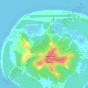
Rimatara
France > French Polynesia > Rimatara
Rimatara, Anapoto, Rimatara, Austral Islands, French Polynesia, 98752, France
Average elevation: 13 m