
Pignerol topographic map
Interactive map
Click on the map to display elevation.
About this map
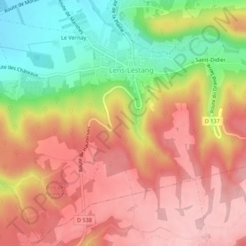
Name: Pignerol topographic map, elevation, terrain.
Average elevation: 375 m
Minimum elevation: 270 m
Maximum elevation: 450 m
Other topographic maps
Click on a map to view its topography, its elevation and its terrain.
Le Vernay
France > Auvergne-Rhône-Alpes > Drôme > Lens-Lestang
Le Vernay, Lens-Lestang, Valence, Drôme, Auvergne-Rhône-Alpes, France métropolitaine, 26210, France
Average elevation: 320 m
Saint-Didier
France > Auvergne-Rhône-Alpes > Drôme > Lens-Lestang
Saint-Didier, Lens-Lestang, Valence, Drôme, Auvergne-Rhône-Alpes, France métropolitaine, 26210, France
Average elevation: 355 m