
Ouargla topographic map
Interactive map
Click on the map to display elevation.
About this map
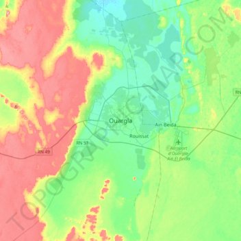
Name: Ouargla topographic map, elevation, terrain.
Location: Ouargla, daïra Ouargla, Ouargla, 30009, Algérie (31.78467 5.16096 32.10467 5.48096)
Average elevation: 165 m
Minimum elevation: 117 m
Maximum elevation: 250 m
Other topographic maps
Click on a map to view its topography, its elevation and its terrain.