
Oplinter topographic map
Interactive map
Click on the map to display elevation.
About this map
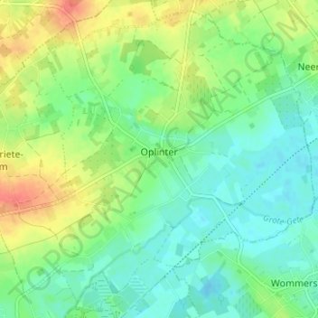
Name: Oplinter topographic map, elevation, terrain.
Location: Oplinter, Tienen, Vlaams-Brabant, Vlaanderen, België (50.81000 4.95756 50.84676 5.01986)
Average elevation: 43 m
Minimum elevation: 26 m
Maximum elevation: 73 m
Other topographic maps
Click on a map to view its topography, its elevation and its terrain.
Kumtich
België > Vlaanderen > Tienen
Kumtich, Tienen, Vlaams-Brabant, Vlaanderen, België
Average elevation: 64 m