
Palmyre topographic map
Interactive map
Click on the map to display elevation.
About this map
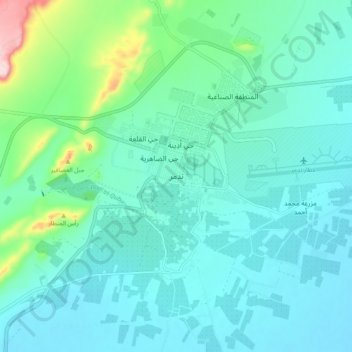
Name: Palmyre topographic map, elevation, terrain.
Location: Palmyre, ناحية تدمر, منطقة تدمر, Gouvernorat de Homs, Syrie (34.51602 38.24097 34.59602 38.32097)
Average elevation: 423 m
Minimum elevation: 377 m
Maximum elevation: 644 m
Other topographic maps
Click on a map to view its topography, its elevation and its terrain.
Al Hawz
Al Hawz, Sous-District de Qoussair, District de Qoussair, Gouvernorat de Homs, Syrie
Average elevation: 503 m
Wadi adh Dhi'ab
Syrie > Gouvernorat de Homs > Al Mashrafah
Wadi adh Dhi'ab, Al Mashrafah, ناحية عين النسر, منطقة حمص, Gouvernorat de Homs, Syrie
Average elevation: 511 m