
Ferriere topographic map
Interactive map
Click on the map to display elevation.
About this map
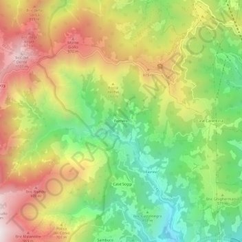
Name: Ferriere topographic map, elevation, terrain.
Location: Ferriere, Ponente, Genova, Liguria, Italia (44.45110 8.67944 44.49110 8.71944)
Average elevation: 591 m
Minimum elevation: 124 m
Maximum elevation: 1,130 m