
Hill 400 topographic map
Interactive map
Click on the map to display elevation.
About this map
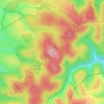
Name: Hill 400 topographic map, elevation, terrain.
Average elevation: 309 m
Minimum elevation: 202 m
Maximum elevation: 395 m
Other topographic maps
Click on a map to view its topography, its elevation and its terrain.
Mishmar HaEmek
Israel > North District > Megido Regional Council > Mishmar HaEmek
Mishmar HaEmek, Megido Regional Council, Jezreel Subdistrict, North District, Israel
Average elevation: 125 m