
Surabaya topographic map
Interactive map
Click on the map to display elevation.
About this map
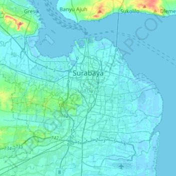
Name: Surabaya topographic map, elevation, terrain.
Location: Surabaya, East Java, Java, Indonesia (-7.35144 112.59157 -7.18423 112.84668)
Average elevation: 8 m
Minimum elevation: -4 m
Maximum elevation: 107 m
Other topographic maps
Click on a map to view its topography, its elevation and its terrain.