
Landrezac topographic map
Interactive map
Click on the map to display elevation.
About this map
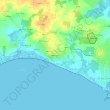
Name: Landrezac topographic map, elevation, terrain.
Average elevation: 9 m
Minimum elevation: -1 m
Maximum elevation: 35 m
Other topographic maps
Click on a map to view its topography, its elevation and its terrain.
Corn er Pont
France > Bretagne > Morbihan > Suscinio
Corn er Pont, Suscinio, Sarzeau, Vannes, Morbihan, Bretagne, France métropolitaine, 56370, France
Average elevation: 11 m