
Polleur topographic map
Interactive map
Click on the map to display elevation.
About this map
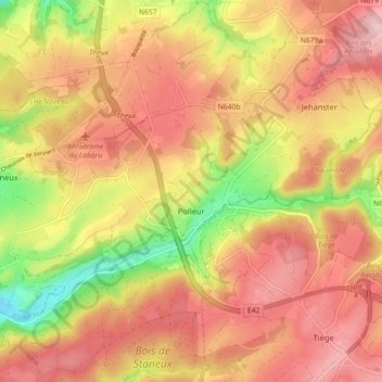
Name: Polleur topographic map, elevation, terrain.
Location: Polleur, Theux, Verviers, Luik, Wallonië, 4910, België (50.51831 5.83199 50.56763 5.92114)
Average elevation: 312 m
Minimum elevation: 182 m
Maximum elevation: 396 m