
Puerto Vallarta topographic map
Interactive map
Click on the map to display elevation.
About this map
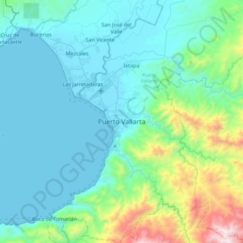
Name: Puerto Vallarta topographic map, elevation, terrain.
Location: Puerto Vallarta, Jalisco, 48300, Mexique (20.48072 -105.38031 20.80072 -105.06031)
Average elevation: 306 m
Minimum elevation: 0 m
Maximum elevation: 1,881 m