
Aa topographic map
Interactive map
Click on the map to display elevation.
About this map
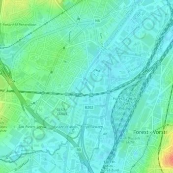
Name: Aa topographic map, elevation, terrain.
Location: Aa, La Roue, Aa, Anderlecht, Bruxelles-Capitale, 1070, Belgique (50.81785 4.30199 50.81986 4.30390)
Average elevation: 28 m
Minimum elevation: 17 m
Maximum elevation: 64 m
Other topographic maps
Click on a map to view its topography, its elevation and its terrain.
Écluse d'Anderlecht
Belgique > Bruxelles-Capitale > Anderlecht > Aa
Écluse d'Anderlecht, La Roue, Aa, Anderlecht, Bruxelles-Capitale, 1070, Belgique
Average elevation: 28 m